


Specific applications
- GIS integration for territorial planning and project management.
- Data preparation for CAD/3D workflows and coordination with BIM environments.
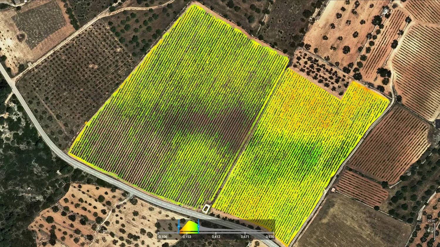
- Multi-temporal monitoring of environmental and restoration projects (baseline + evolution).
- Inventories and thematic mapping for public administrations and technical consultancies.
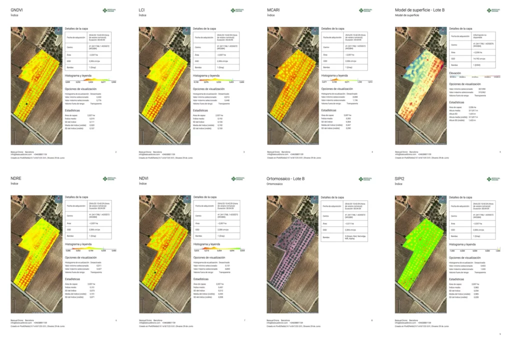
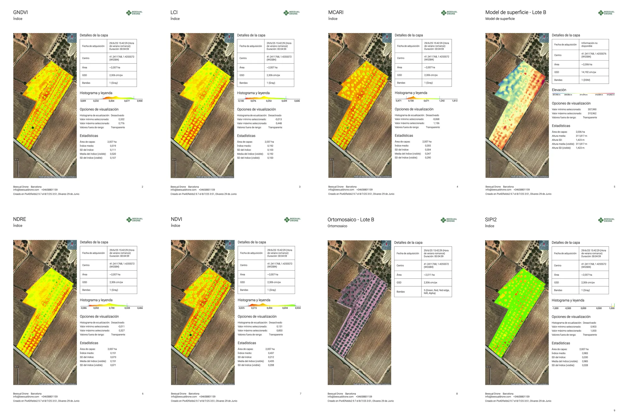
- GIS deliverable packages for reporting and decision-making (layers, maps, and tables).
What we do
- We provide advanced GIS and BIM services for territorial planning projects, data integration, and decision-oriented spatial analysis.
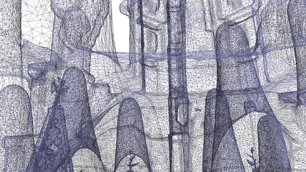
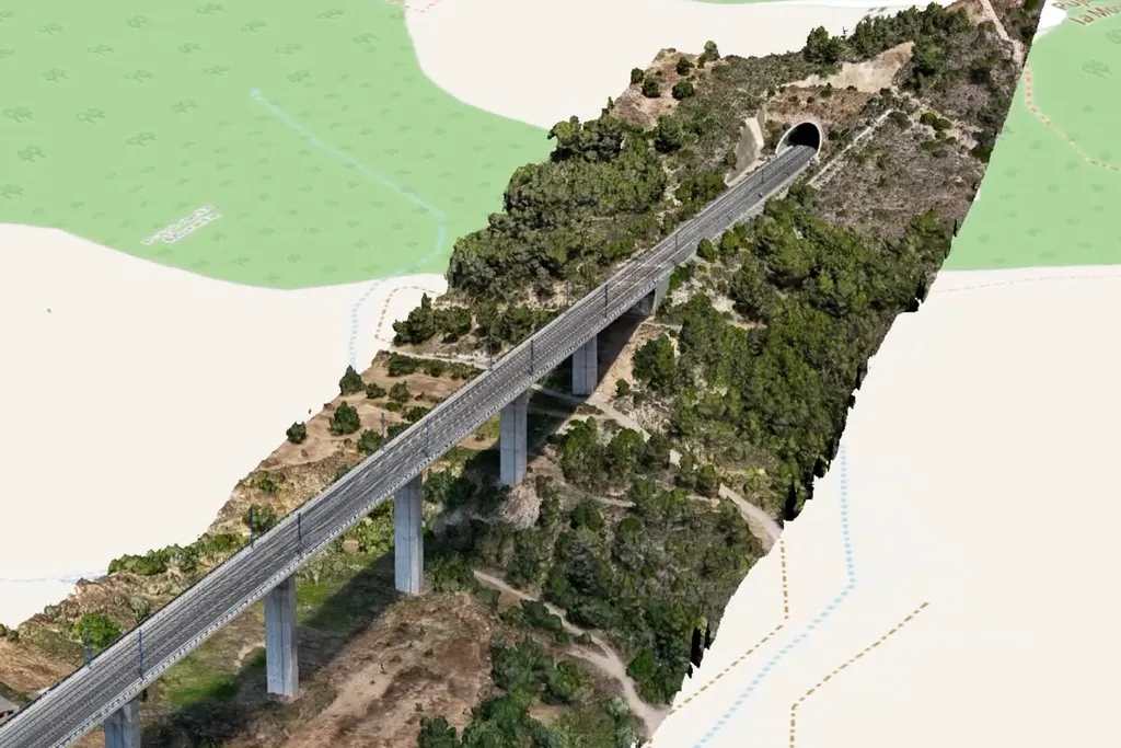
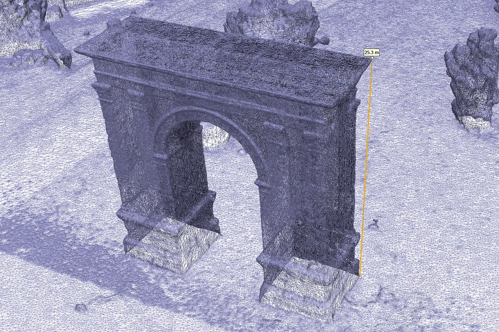
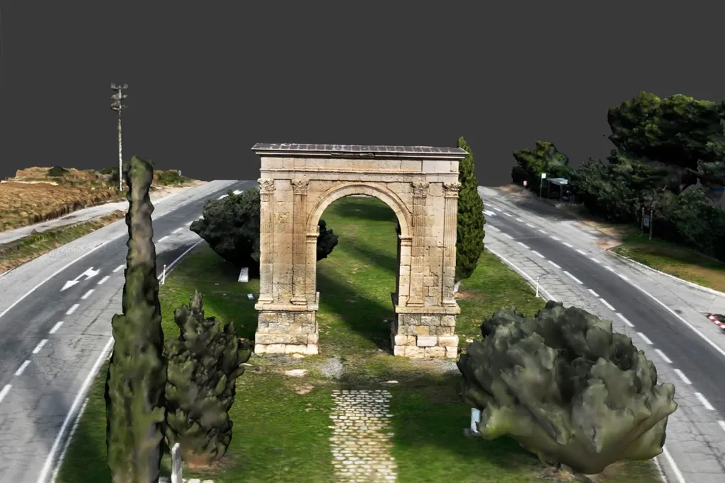
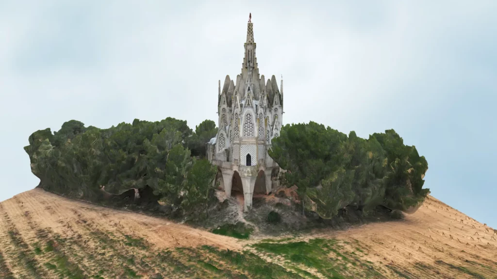
- Technical modeling and 3D documentation applied to civil works, heritage, and land management projects.
- GIS data integration and preparation of ready-to-use layers for QGIS and CAD/3D workflows.
- Applied territorial analysis: area delimitation, zoning, change over time, and thematic layers for planning.
- Design of monitoring campaigns and multi-temporal comparison (baseline + evolution) to track environmental and territorial projects.
- Technical validation and interpretation of results, with consistent geospatial deliverables for technical teams and decision-makers.