


Technical Capabilities
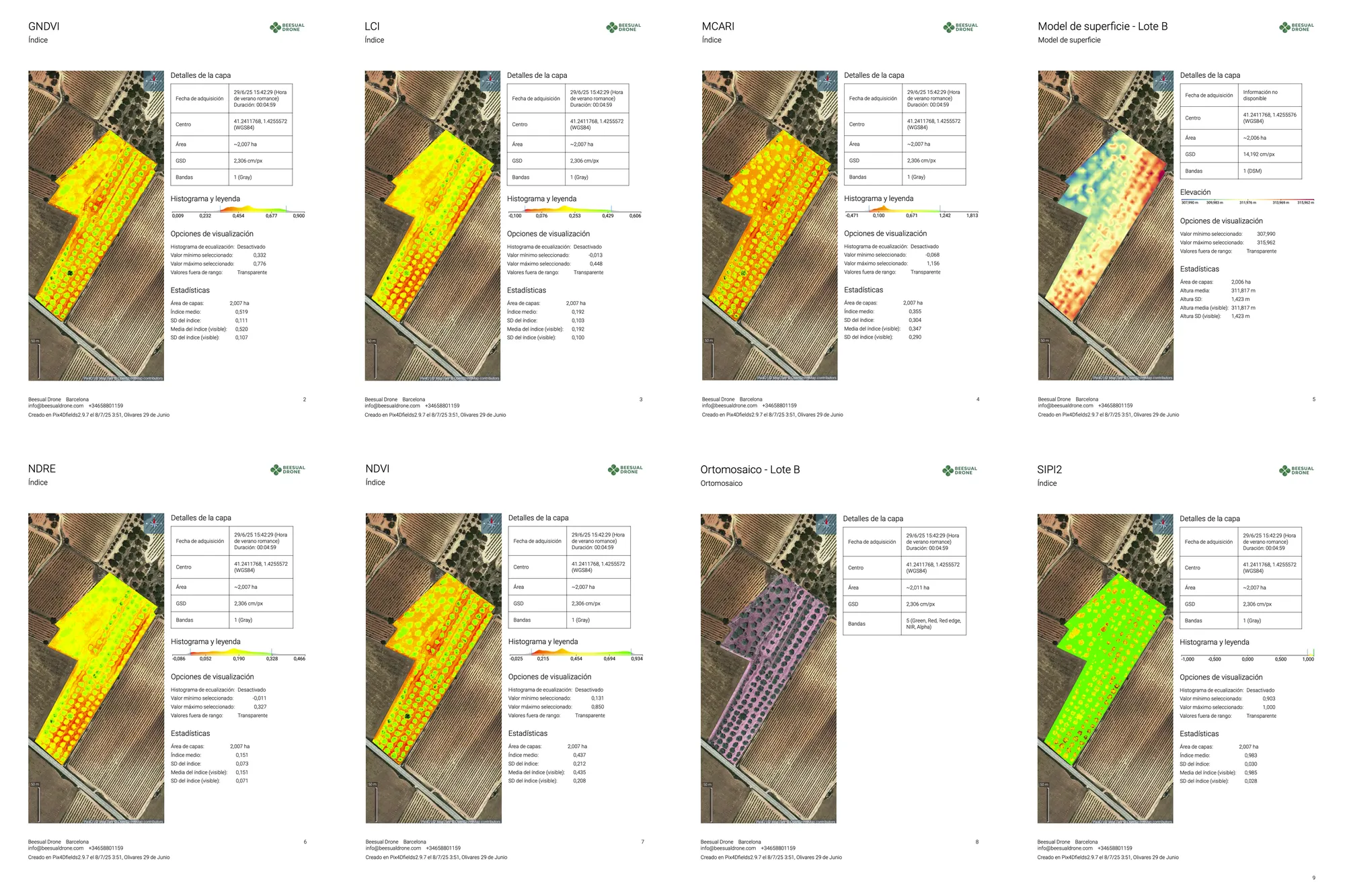
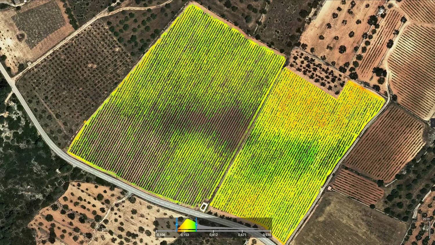
At Beesual Drone we develop AI solutions for geospatial analysis that turn raw data into actionable technical insights. Our custom pipelines combine computer vision, thermal processing and Python/n8n automation to solve complex cases in agriculture, environment and public management.
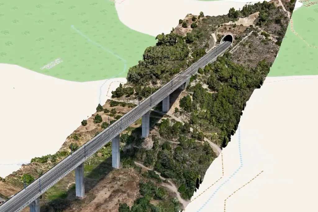
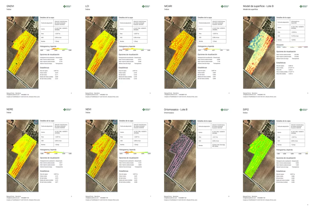
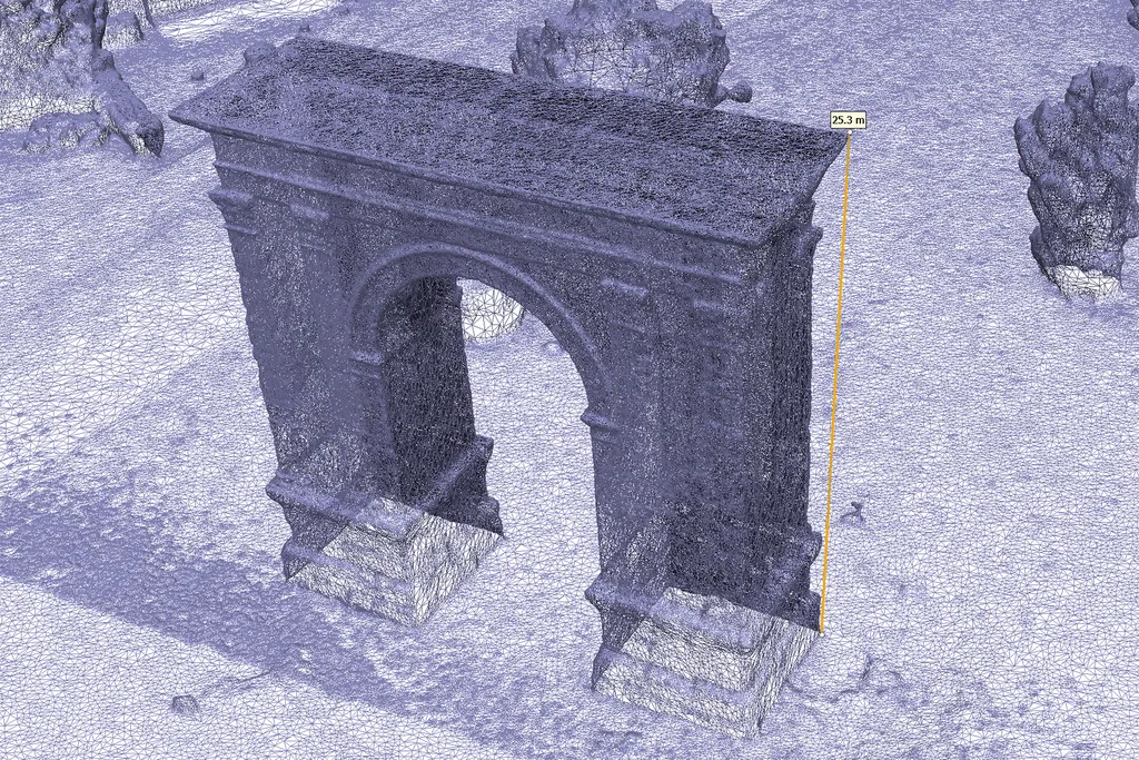
Every project is designed around your operational needs. We deliver vector layers, point clouds and 3D models directly compatible with QGIS, AutoCAD or Revit. We also generate interactive web dashboards for multi‑temporal monitoring of key indicators. All processing runs on secure local servers, guaranteeing absolute confidentiality of your territorial data.
If your case requires automatic anomaly detection, advanced thermal calibration or integration with IoT stations, we design the workflow from scratch and deliver methodologically validated results.
- Automatic detection with Onboard AI: Real‑time identification of thermal stress zones, anomalies or specific objects using YOLOv8 models embedded in the drone.
- Advanced thermal analysis (CWSI): Quantification of water stress and stomatal efficiency in woody crops with calibrated thermal sensors.
- Multi‑source data fusion: Integration of historical satellite imagery, high‑resolution UAV flights and IoT data (weather stations) for a complete territorial context.
- GIS automation: Development of custom QGIS/Python scripts to process large volumes of repetitive data consistently and rapidly.
Analysis Methodology
- We turn raw imagery into actionable technical information through custom processing pipelines.
- Tailored development: we adapt AI models and analysis scripts (Python/n8n) to the specific needs of your project or crop.
- BIM and CAD integration: we deliver vector layers, point clouds and 3D models ready to import into QGIS, AutoCAD or Revit without friction.
- Interactive dashboards: generation of web reports (HTML/Folium) for temporal monitoring of key indicators from any device.
- Total privacy: all processing and model training is carried out on secure local servers, guaranteeing the confidentiality of your data.