
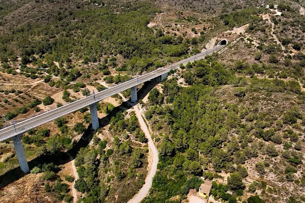
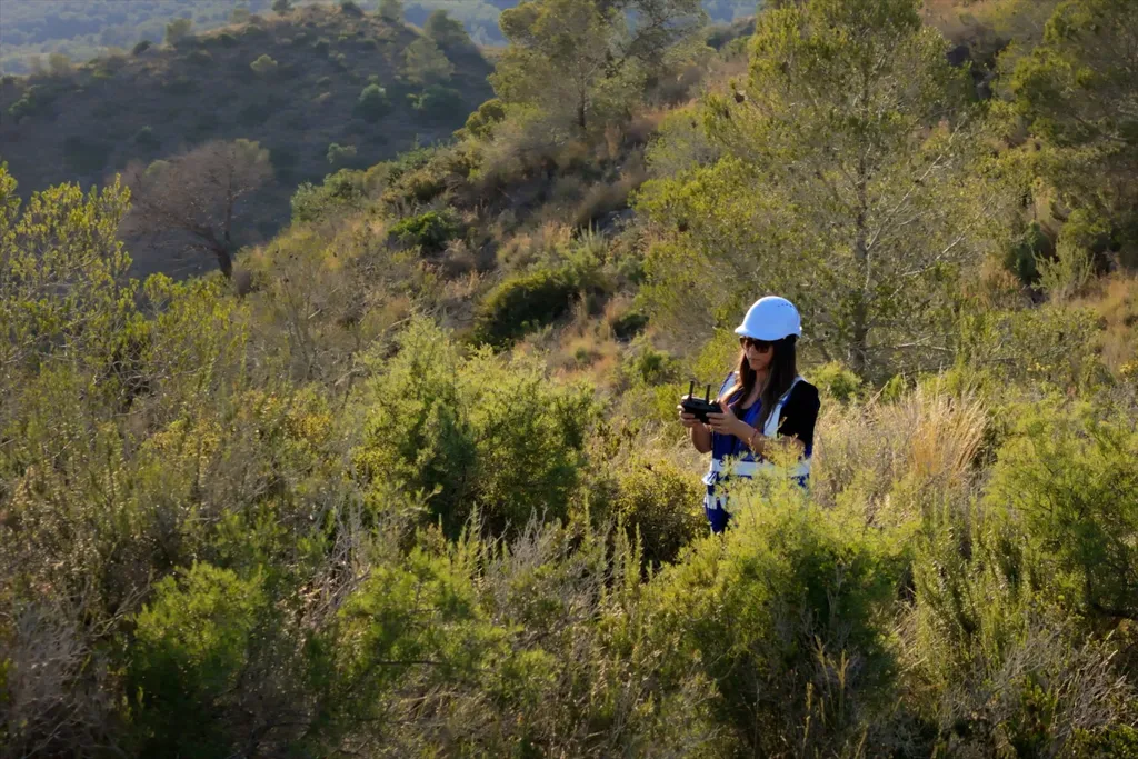
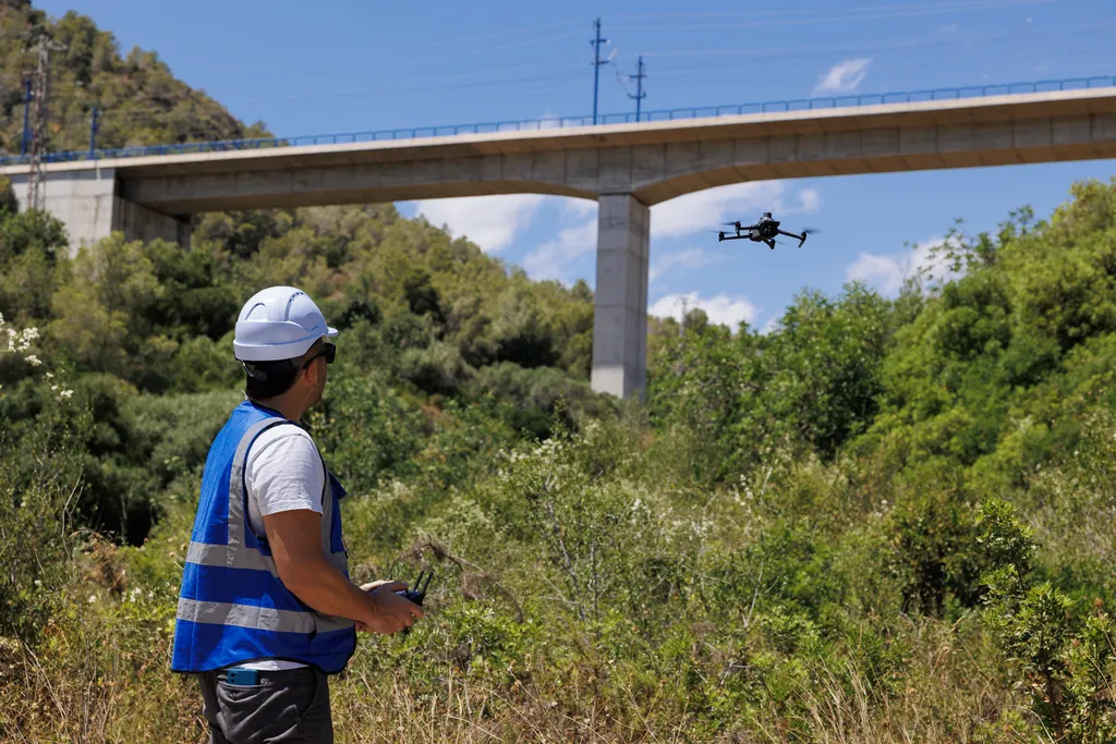
Drone surveying for civil works and technical projects: we produce orthomosaics, digital terrain models, and point clouds ready for CAD/GIS. Ideal for construction monitoring, volume measurements, and infrastructure documentation—reducing field time and improving safety in hard-to-access areas.
Target Audience
Engineers, surveyors, municipal technicians, and construction companies.
What we do
- Drone-based topographic surveys for civil works and technical projects.
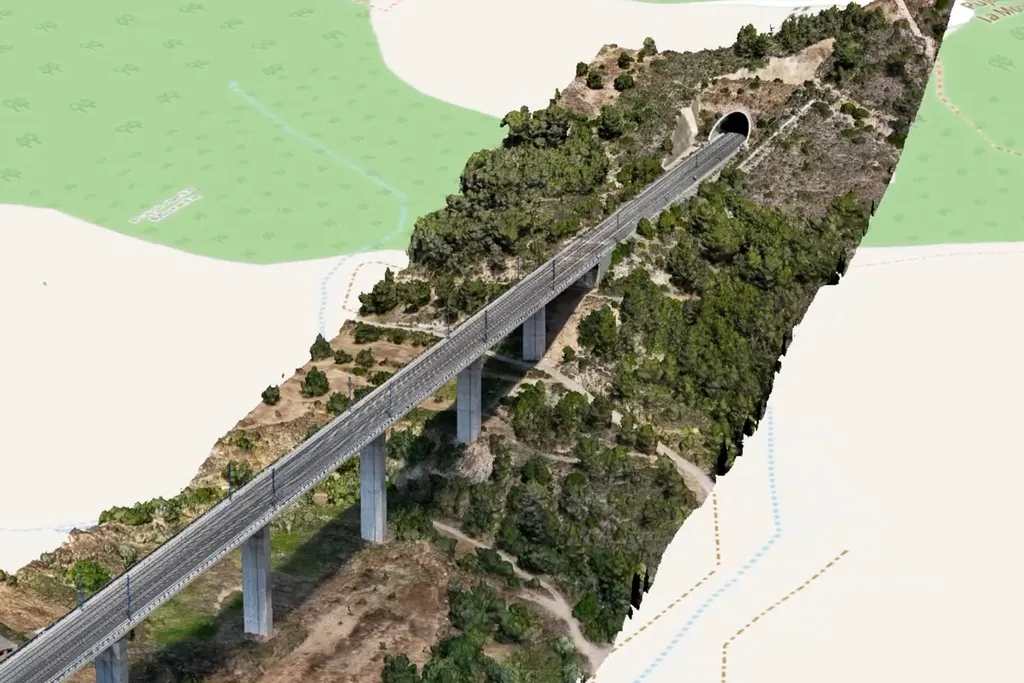
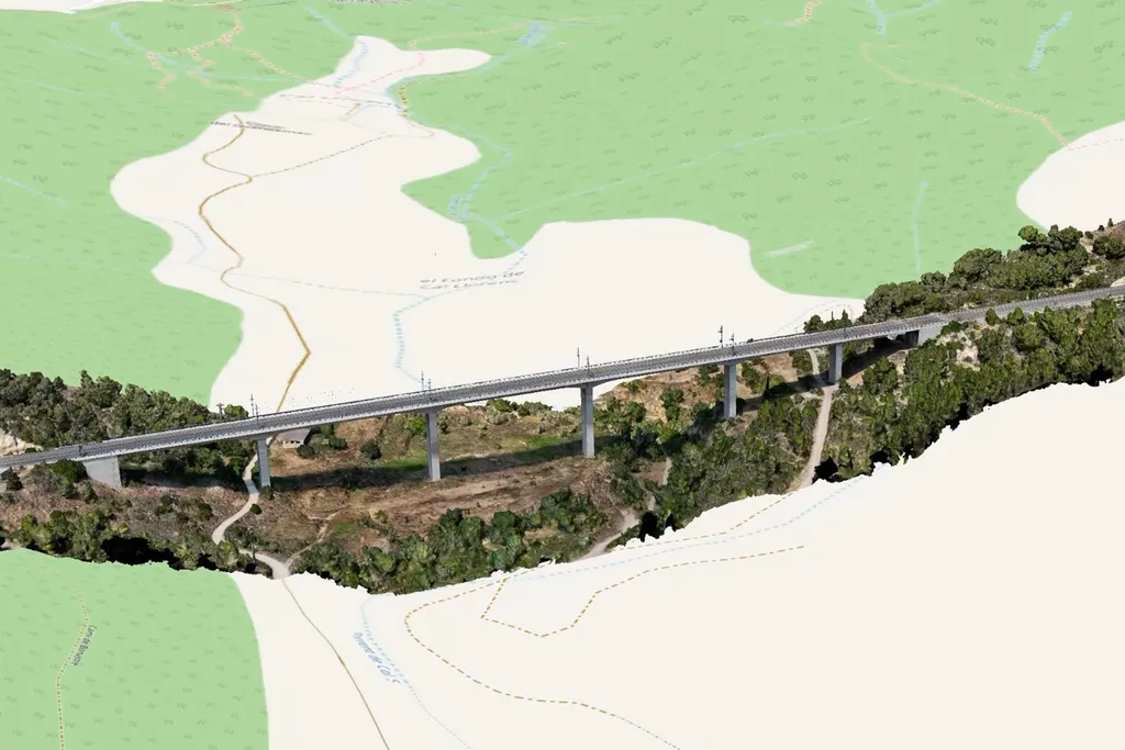
- Georeferenced orthomosaics, point clouds, and digital terrain models (DTM/DSM).
- Contour lines, profiles, and volume calculations (cut/fill).
- Integration of deliverables into CAD and GIS workflows; coordination with BIM teams when applicable.
- Technical visual documentation of structures and hard-to-access areas (bridges, slopes/embankments, pipelines).
Deliverables
- Georeferenced orthophoto + PDF map for construction.
- DTM/DSM and derived products (contours and profiles).
- Point cloud and/or 3D mesh for measurement and analysis.
- Volume calculations and date-to-date comparisons for progress tracking.
- CAD/GIS-ready layers aligned with the technical team’s workflow.
Value We Provide
We reduce survey time and improve field safety by delivering high-accuracy data and consistent deliverables for technical teams. Final accuracy depends on site conditions and the georeferencing method used; we define the delivery standard before flying.
Do you need a reliable topographic survey for your construction project?
Tell us the location, area, and objective (contours, volumes, DTM/DSM, or point cloud) and we’ll send you a proposal with timelines and a sample set of deliverables tailored to your team.